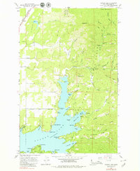
1961 Map of Hayden Lake
USGS Topo · Published 1979About this map
Hayden Lake serves as the focal point of this 1961 field-checked survey, showing the intricate shoreline and recreational development of the Kootenai County landscape. Significant landmarks include The Clark House and Clarksville near the southern shore, while Harris Landing and Rockaway Beach provide access points along the western edge. The map captures the interface between private holdings and the Coeur d'Alene National Forest, where resource extraction is evident at the Shamrock Mine and Commonwealth Mine tucked into the canyons of Hayden Creek.
Find a feature on this map
67 named features on this map. Tap any name to fly to it.
Don’t see what you’re looking for? This feature index may not catch every label — zoom into the map to look around manually.
Map Details
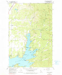
Editions of this 1961 Hayden Lake Map
3 editions found

Other maps of this area

1903 · Rathdrum
USGS Topo · 1:125,000

1955 · Spokane
USGS Topo · 1:250,000

1957 · Coeur D'Alene
USGS Topo · 1:62,500

1957 · Lane
USGS Topo · 1:62,500

1958 · Spokane
USGS Topo · 1:250,000

1961 · Hayden
USGS Topo · 1:24,000

1961 · Bayview
USGS Topo · 1:24,000

1961 · Spirit Lake East
USGS Topo · 1:24,000

1961 · Athol
USGS Topo · 1:24,000

1961 · Spirit Lake
USGS Topo · 1:62,500