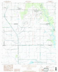
1984 Map of Hayes
USGS Topo · Published 1985About this map
The low-lying coastal prairies and wetlands of Calcasieu Parish are meticulously detailed in this mid-1980s provisional study. The settlement of Hayes and the nearby community of Bell City serve as the primary hubs in a landscape defined by an extensive system of levees and man-made waterways. The Bell City Drainage Canal and Morgan Canal cut through the terrain, illustrating the significant engineering required to manage water in this region. This interplay between land and water is further emphasized by the southern boundary of the map, which includes a portion of the Lacassine National Wildlife Refuge. Industrial activity is noted at the Illinois Plant, while the presence of locations like Wild Island, Pine Island, and Oak Island highlights the slightly elevated features that rise above the surrounding Willow Marsh. The map also captures the complex parish boundaries where Calcasieu, Jefferson Davis, and Cameron parishes meet.
Find a feature on this map
16 named features on this map. Tap any name to fly to it.
Don’t see what you’re looking for? This feature index may not catch every label — zoom into the map to look around manually.
Map Details
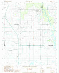
Editions of this 1984 Hayes Map
2 editions found
Other maps of this area

1932 · Lake Charles NE
USGS Topo · 1:31,680

1932 · Lake Charles SE
USGS Topo · 1:31,680

1934 · Lake Misere
USGS Topo · 1:24,000

1934 · Boudreaux Lake
USGS Topo · 1:24,000

1934 · Latania Lake
USGS Topo · 1:24,000

1935 · Lake Misere
USGS Topo · 1:31,680

1935 · Latania Lake
USGS Topo · 1:31,680

1935 · Boudreaux Lake
USGS Topo · 1:31,680

1942 · Lake Charles
USGS Topo · 1:62,500

1946 · Lacassine
USGS Topo · 1:31,680