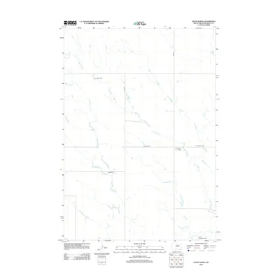
2012 Map of Hayes North
USGS Topo · Published 2012About this map
The northern plains of Stanley County are defined by a sparse ranching landscape where seasonal drainages dictate the location of local homesteads. Two primary watercourses, Frozen Man Cr and Wagonhound Cr, meander through the prairie, providing the necessary geography for established holdings like the B Stoeser Ranch and Riggle Ranch. The influence of early 21st-century aviation infrastructure is visible at the southern edge of the map, where the Hayes Emergency Strip serves as a critical point of navigation in this expansive territory. Transportation is concentrated along Hayes Rd, which connects the distributed family operations of A A Burgeson Ranch and others to the wider region. This survey documents a traditional South Dakota ranching economy that remained resilient and geographically consistent through the turn of the millennium.
Find a feature on this map
9 named features on this map. Tap any name to fly to it.
Don’t see what you’re looking for? This feature index may not catch every label — zoom into the map to look around manually.
Map Details
Editions of this 2012 Hayes North Map
This is the sole edition of this map. No revisions or reprints were ever made.
Other maps of this area

1954 · Pierre
USGS Topo · 1:250,000

1958 · Pierre
USGS Topo · 1:250,000

1980 · Princes Ranch
USGS Topo · 1:25,000

1982 · Sansarc
USGS Topo · 1:24,000

1982 · Hayes South
USGS Topo · 1:24,000

1982 · Whiteman Ranch
USGS Topo · 1:24,000

1982 · Hohrman Ranch
USGS Topo · 1:24,000

1982 · May Ranch
USGS Topo · 1:24,000

1983 · Bentley Ranch
USGS Topo · 1:24,000

1983 · Hayes North
USGS Topo · 1:24,000