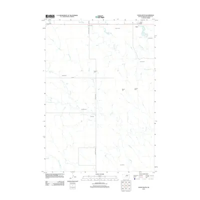
2012 Map of Hayes South
USGS Topo · Published 2012About this map
Hayes stands at the northern edge of this West River landscape, serving as a focal point for the surrounding cattle ranches of Stanley County. The ranching heritage of the region is evident through numerous named family operations, including Purcell Ranch, Groff Ranch, and Kirkpatrick Ranch. These holdings are scattered across a terrain defined by intermittent waterways such as Wagonhound Cr, Plum Cr, and Frozen Man Cr. Transportation and local infrastructure are represented by the Hayes Emergency Airstrip and a network of gravel roads like S Brown Co Hwy and Hayes Rd. The topographic character of the Great Plains is further distinguished by prominent local landmarks, including Round Top and Lookout Point, while Hayes Lake provides a critical water source in this semi-arid environment.
Find a feature on this map
25 named features on this map. Tap any name to fly to it.
Don’t see what you’re looking for? This feature index may not catch every label — zoom into the map to look around manually.
Map Details
Editions of this 2012 Hayes South Map
This is the sole edition of this map. No revisions or reprints were ever made.
Other maps of this area

1951 · Capa NW
USGS Topo · 1:24,000

1954 · Pierre
USGS Topo · 1:250,000

1958 · Pierre
USGS Topo · 1:250,000

1980 · Princes Ranch
USGS Topo · 1:25,000

1982 · Hayes South
USGS Topo · 1:24,000

1982 · Hohrman Ranch
USGS Topo · 1:24,000
1982 · Midland NE
USGS Topo · 1:24,000

1982 · Midland NW
USGS Topo · 1:24,000

1982 · May Ranch
USGS Topo · 1:24,000

1983 · Bentley Ranch
USGS Topo · 1:24,000