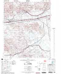
2002 Map of Hayfield
USGS Topo · Published 2004About this map
Chuckwalla Valley serves as a critical infrastructure corridor in this 2002 survey of the Colorado Desert. The landscape is defined by the convergence of the Eagle Mountains, Orocopia Mountains, and Chocolate Mountains. At the heart of the valley, an underground pipeline and a pumping station support the regional water network, while small settlements like Hayfield and Chiriaco Summit provide isolated outposts along the primary thoroughfare.
Find a feature on this map
24 named features on this map. Tap any name to fly to it.
Don’t see what you’re looking for? This feature index may not catch every label — zoom into the map to look around manually.
Map Details
Editions of this 2002 Hayfield Map
This is the sole edition of this map. No revisions or reprints were ever made.
Other maps of this area

1940 · Frink
USGS Topo · 1:62,500

1940 · Cottonwood Spring
USGS Topo · 1:62,500

1940 · Iris Pass
USGS Topo · 1:62,500

1940 · Canyon Spring
USGS Topo · 1:62,500

1940 · Durmid
USGS Topo · 1:62,500

1943 · Canyon Spring
USGS Topo · 1:62,500

1943 · Coxcomb Mountains
USGS Topo · 1:62,500

1943 · Pinkham Well
USGS Topo · 1:62,500

1944 · Cottonwood Spring
USGS Topo · 1:62,500

1944 · Pinkham Well
USGS Topo · 1:62,500