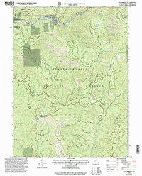
1998 Map of Hayfork Bally
USGS Topo · Published 2003About this map
The Trinity River snakes through the northern portion of this map, defining a corridor of activity marked by Feather Rapids and the settlement of Big Bar. This territory, situated within the Shasta-Trinity National Forest, highlights the intersection of resource extraction and early recreational development. While the Kottmeier Mine suggests the region's industrial past, the presence of the Skunk Point Campground and Burnt Ranch Campground near the riverbanks reflects a transition toward public land management by the late twentieth century.
Find a feature on this map
40 named features on this map. Tap any name to fly to it.
Don’t see what you’re looking for? This feature index may not catch every label — zoom into the map to look around manually.
Map Details
Editions of this 1998 Hayfork Bally Map
This is the sole edition of this map. No revisions or reprints were ever made.
Other maps of this area

1909 · Big Bar
USGS Topo · 1:96,000

1915 · Big Bar and Vicinity
USGS Topo · 1:250,000

1951 · Hayfork
USGS Topo · 1:62,500

1951 · Helena
USGS Topo · 1:62,500

1951 · Hyampom
USGS Topo · 1:62,500

1951 · Ironside Mountain
USGS Topo · 1:62,500

1958 · Redding
USGS Topo · 1:250,000

1982 · Helena
USGS Topo · 1:24,000
1982 · Big Bar
USGS Topo · 1:24,000
1982 · Hayfork Bally
USGS Topo · 1:24,000