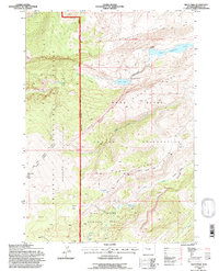
1991 Map of Hays Park
USGS Topo · Published 1997About this map
Shoshone National Forest contains a complex intersection of administrative and natural boundaries, prominently featuring the Wind River Indian Reservation line that bisects the landscape. The high-altitude terrain is defined by dramatic geological formations like Sacagawea Ridge and Dinwoody Ridge, which overlook the glacial waters of Upper Dinwoody Lake and the smaller Mud Lake. The presence of the Fitzpatrick Wilderness and the Wind River Roadless Area highlights a commitment to preserving the primitive character of this part of the Wind River Range during the late twentieth century.
Find a feature on this map
26 named features on this map. Tap any name to fly to it.
Don’t see what you’re looking for? This feature index may not catch every label — zoom into the map to look around manually.
Map Details
Editions of this 1991 Hays Park Map
This is the sole edition of this map. No revisions or reprints were ever made.
Other maps of this area

1909 · Fremont Peak
USGS Topo · 1:125,000

1952 · Wilderness
USGS Topo · 1:24,000

1952 · Hays Park
USGS Topo · 1:24,000

1952 · Bob Lakes
USGS Topo · 1:24,000

1952 · Blue Holes
USGS Topo · 1:24,000

1952 · Burris
USGS Topo · 1:24,000

1952 · Kirkland Park
USGS Topo · 1:24,000

1955 · Thermopolis
USGS Topo · 1:250,000

1958 · Thermopolis
USGS Topo · 1:250,000

1962 · Thermopolis
USGS Topo · 1:250,000