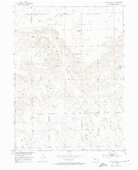
1953 Map of Haystack Butte
USGS Topo · Published 1974About this map
Peetz Table defines the high-plains geography of this corner of Logan County, where the transition from flat tablelands to deeply eroded draws illustrates the classic topography of northeastern Colorado. The landscape in the early 1950s is marked by sparse but critical water management, featuring the North Sterling Outlet Canal and North Sterling Lateral. These irrigation features, along with numerous windmills, underscore the area's reliance on managed water for agriculture and ranching.
Find a feature on this map
14 named features on this map. Tap any name to fly to it.
Don’t see what you’re looking for? This feature index may not catch every label — zoom into the map to look around manually.
Map Details
Editions of this 1953 Haystack Butte Map
2 editions found
Other maps of this area

1899 · Sidney
USGS Topo · 1:125,000

1951 · Iliff
USGS Topo · 1:24,000

1953 · Peetz
USGS Topo · 1:24,000

1953 · Crook
USGS Topo · 1:24,000

1953 · Twin Buttes
USGS Topo · 1:24,000

1953 · Proctor
USGS Topo · 1:24,000

1953 · Haystack Butte
USGS Topo · 1:24,000

1954 · Sterling
USGS Topo · 1:250,000

1954 · Scottsbluff
USGS Topo · 1:250,000

1958 · Scottsbluff
USGS Topo · 1:250,000