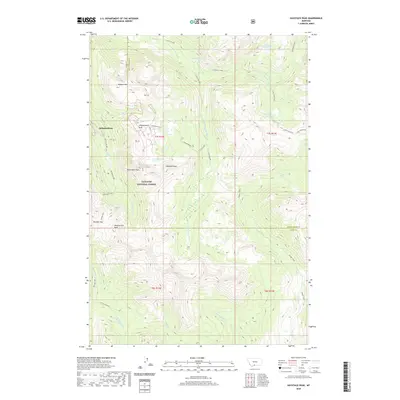
2020 Map of Haystack Peak
USGS Topo · Published 2020About this map
Independence sits within a high alpine environment where the headwaters of the Boulder River and Slough Creek begin their descent. This 2020 survey of the Gallatin National Forest reveals a landscape dominated by dramatic summits, including Haystack Peak, Independence Peak, and Sheepherder Peak. The complex drainage patterns of the region are evident as the E Fork Buffalo Fork and N Fork Bull Cr carve through the southern reaches of the quadrangle. High-elevation water bodies like Lake Kathleen, Blue Lake, and the Lake Columbine chain are characteristic of this glaciated terrain. The map also delineates the high-country transition at Boulder Pass and the prominent Buffalo Divide, which serves as a natural boundary between major watersheds. Local landmarks such as Baboon Mtn and Monument Peak provide distinct points of reference for those navigating this portion of the Absaroka-Beartooth wilderness area.
Find a feature on this map
43 named features on this map. Tap any name to fly to it.
Don’t see what you’re looking for? This feature index may not catch every label — zoom into the map to look around manually.
Map Details
Editions of this 2020 Haystack Peak Map
This is the sole edition of this map. No revisions or reprints were ever made.
Other maps of this area

1891 · Livingston
USGS Topo · 1:250,000

1893 · Livingston
USGS Topo · 1:250,000

1940 · Mt. Cowen
USGS Topo · 1:62,500

1940 · Mt Wallace
USGS Topo · 1:62,500

1941 · Mt Douglas
USGS Topo · 1:62,500

1942 · Cutoff Mtn
USGS Topo · 1:62,500

1943 · Mt Wallace
USGS Topo · 1:62,500

1943 · Mt Douglas
USGS Topo · 1:62,500

1943 · Mt Cowen
USGS Topo · 1:62,500

1944 · Cutoff Mtn
USGS Topo · 1:62,500