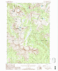
1987 Map of Haystack Peak
USGS Topo · Published 1988About this map
Independence (Site) serves as a primary historical waypoint in this high-elevation mountain terrain within the Gallatin National Forest. Evidence of late-19th-century mining activity persists at the Independence Mine and near Independence Peak, where the landscape is defined by steep ridges and glacial lakes. The area is divided by the Absaroka-Beartooth Wilderness boundary, marking a transition into protected backcountry. The drainage of the East Fork Boulder River and high-altitude water bodies like Lake Kathleen, Blue Lake, and Lake Columbine suggest a landscape shaped by persistent snowpack and remote conditions. Numerous pack trails crisscross the ridges, connecting the Boulder Pass to the headwaters of Slough Creek and Buffalo Creek, illustrating the primitive transportation network required to navigate the Park and Sweet Grass county line.
Find a feature on this map
28 named features on this map. Tap any name to fly to it.
Don’t see what you’re looking for? This feature index may not catch every label — zoom into the map to look around manually.
Map Details
Editions of this 1987 Haystack Peak Map
This is the sole edition of this map. No revisions or reprints were ever made.
Other maps of this area

1891 · Livingston
USGS Topo · 1:250,000

1893 · Livingston
USGS Topo · 1:250,000

1940 · Mt. Cowen
USGS Topo · 1:62,500

1940 · Mt Wallace
USGS Topo · 1:62,500

1941 · Mt Douglas
USGS Topo · 1:62,500

1942 · Cutoff Mtn
USGS Topo · 1:62,500

1943 · Mt Wallace
USGS Topo · 1:62,500

1943 · Mt Douglas
USGS Topo · 1:62,500

1943 · Mt Cowen
USGS Topo · 1:62,500

1944 · Cutoff Mtn
USGS Topo · 1:62,500