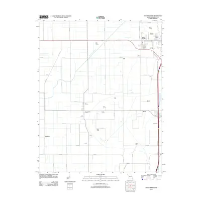
2012 Map of Hayti Heights
USGS Topo · Published 2012About this map
Braggadocio and Hayti Heights anchor this corner of Pemiscot County, where the agricultural grid of the Missouri Bootheel is defined by an intricate network of drainage and transport. The landscape is dominated by the Main Ditch Number 8, a critical piece of water management infrastructure that enabled the development of the region's productive farmlands. Numerous family and community burial grounds, such as Saint Johns Cemetery, Cupp Cemetery, and the Long Cemeteries, are scattered throughout the countryside, offering significant data points for genealogists and local historians.
Find a feature on this map
68 named features on this map. Tap any name to fly to it.
Don’t see what you’re looking for? This feature index may not catch every label — zoom into the map to look around manually.
Map Details
Editions of this 2012 Hayti Heights Map
This is the sole edition of this map. No revisions or reprints were ever made.
Other maps of this area

1939 · Portageville
USGS Topo · 1:62,500

1939 · Caruthersville
USGS Topo · 1:62,500

1940 · Pascola
USGS Topo · 1:62,500

1940 · Hayti
USGS Topo · 1:62,500

1951 · Caruthersville
USGS Topo · 1:62,500

1955 · Pascola
USGS Topo · 1:62,500

1955 · Hayti
USGS Topo · 1:62,500

1955 · Portageville
USGS Topo · 1:62,500

1956 · Dyersburg
USGS Topo · 1:250,000

1957 · Caruthersville
USGS Topo · 1:62,500