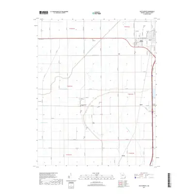
2017 Map of Hayti Heights
USGS Topo · Published 2017About this map
Hayti Heights and Hayti anchor this portion of the Missouri Bootheel, revealing a landscape defined by an extensive drainage network and agricultural heritage. The geometry of the land is shaped by numbered waterways such as Main Ditch Number 8 and Ditch Number 21, essential infrastructure for the fertile plains of Pemiscot County. The presence of numerous family and community burial sites, including Saint Johns Cem, Morgan Cem, and the Long Cemeteries, speaks to a deeply rooted local history and genealogy. Settled pockets like Braggadocio and Micola are linked by a grid of county roads and state highways, including State HWY Z and Old Us HWY 412. The terrain is remarkably level, interrupted only by the subtle elevation of Blow Ridge in the central township. This map serves as a detailed record of land use and property divisions in the late 2010s, showing the intersection of rural life and engineered water management.
Find a feature on this map
88 named features on this map. Tap any name to fly to it.
Don’t see what you’re looking for? This feature index may not catch every label — zoom into the map to look around manually.
Map Details
Editions of this 2017 Hayti Heights Map
This is the sole edition of this map. No revisions or reprints were ever made.
Other maps of this area

1939 · Portageville
USGS Topo · 1:62,500

1939 · Caruthersville
USGS Topo · 1:62,500

1940 · Pascola
USGS Topo · 1:62,500

1940 · Hayti
USGS Topo · 1:62,500

1951 · Caruthersville
USGS Topo · 1:62,500

1955 · Pascola
USGS Topo · 1:62,500

1955 · Hayti
USGS Topo · 1:62,500

1955 · Portageville
USGS Topo · 1:62,500

1956 · Dyersburg
USGS Topo · 1:250,000

1957 · Caruthersville
USGS Topo · 1:62,500