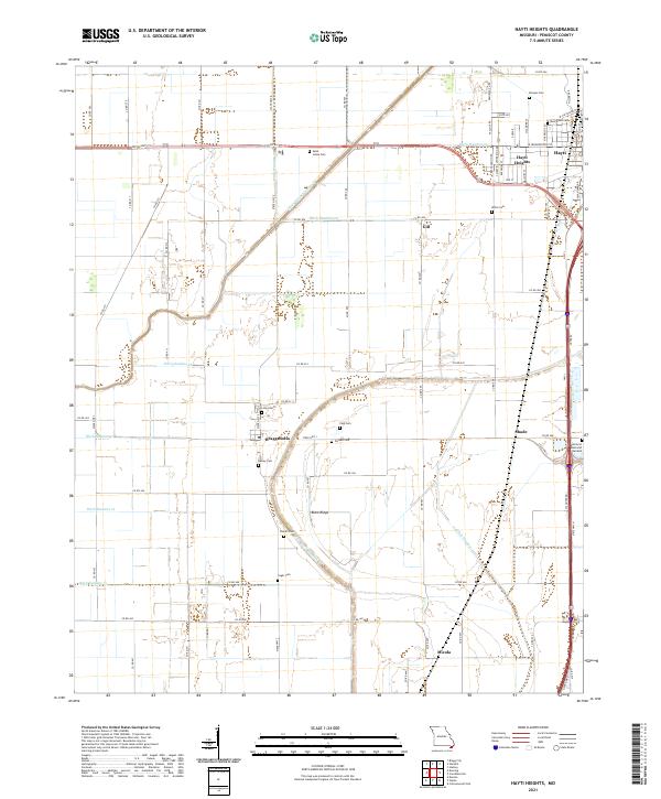
2021 Map of Hayti Heights
USGS Topo · Published 2021About this map
The community of Hayti Heights and the neighboring city of Hayti dominate the northern landscape of this Missouri Bootheel survey, defined by a rigorous grid of drainage canals. This network, including Main Ditch Number 8 and Ditch Number 20, illustrates the extensive engineering required to manage the wetlands of Pemiscot County for agriculture and habitation. The map reveals a high density of small family or community burial grounds, such as Morgan Cem, Saint Johns Cem, and Cagle Cem, which are invaluable for genealogists tracing family ties in rural settlements like Braggadocio and Micola. South of the urban centers, the terrain transitions into more open farmland, punctuated by subtle elevations like Blow Ridge and small clusters of homes at Gill and Shade. The alignment of Old US Hwy 412 and Interstate 55 provides the backbone for the region's connectivity, cutting across the low-lying fields.
Find a feature on this map
81 named features on this map. Tap any name to fly to it.
Don’t see what you’re looking for? This feature index may not catch every label — zoom into the map to look around manually.
Map Details
Editions of this 2021 Hayti Heights Map
This is the sole edition of this map. No revisions or reprints were ever made.
Other maps of this area

1939 · Portageville
USGS Topo · 1:62,500

1939 · Caruthersville
USGS Topo · 1:62,500

1940 · Pascola
USGS Topo · 1:62,500

1940 · Hayti
USGS Topo · 1:62,500

1951 · Caruthersville
USGS Topo · 1:62,500

1955 · Pascola
USGS Topo · 1:62,500

1955 · Hayti
USGS Topo · 1:62,500

1955 · Portageville
USGS Topo · 1:62,500

1956 · Dyersburg
USGS Topo · 1:250,000

1957 · Caruthersville
USGS Topo · 1:62,500