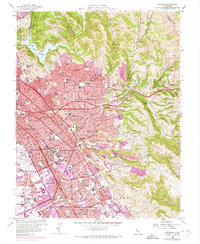
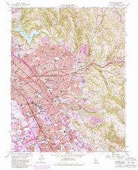
1959 Map of Hayward
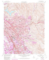
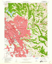
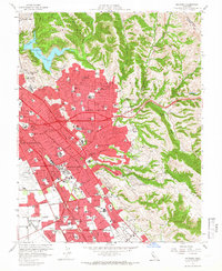
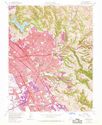
USGS Topo · Published 1980About this map
Hayward and the surrounding East Bay communities are shown here during a period of significant suburban expansion and infrastructure development. The landscape is defined by the steep terrain of the San Leandro Hills and Walpert Ridge, which hem in the growing residential blocks of Castro Valley and San Lorenzo. Major transportation arteries like the Macarthur Freeway and Nimitz Freeway are visible cutting through the valley, reflecting the mid-century shift toward automobile-centric transit.
Find a feature on this map
92 named features on this map. Tap any name to fly to it.
Don’t see what you’re looking for? This feature index may not catch every label — zoom into the map to look around manually.
Map Details
Editions of this 1959 Hayward Map
6 editions found
Other maps of this area

1896 · Mt. Diablo
USGS Topo · 1:62,500

1897 · Concord
USGS Topo · 1:62,500

1898 · Mt. Diablo
USGS Topo · 1:62,500

1899 · Haywards
USGS Topo · 1:62,500

1906 · Pleasanton
USGS Topo · 1:62,500

1915 · Haywards
USGS Topo · 1:62,500

1915 · Concord
USGS Topo · 1:62,500

1941 · Pleasanton
USGS Topo · 1:62,500

1942 · Concord
USGS Topo · 1:62,500

1942 · Hayward
USGS Topo · 1:62,500