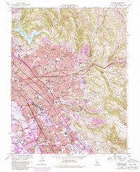
1959 Map of Hayward
USGS Topo · Published 1980About this map
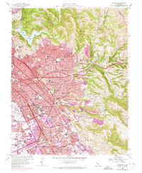
Hayward and its surrounding communities are shown during a period of significant post-war expansion, with extensive residential developments filling the spaces between the Southern Pacific and Western Pacific rail lines. The map reveals the civic heart of the area, including the Alameda County Bldg and the California State Armory Hayward. To the north, the protected hills of Anthony Chabot Regional Park and Lake Chabot provide a stark contrast to the burgeoning urban grid of San Lorenzo and Castro Valley.
Find a feature on this map
109 named features on this map. Tap any name to fly to it.
Don’t see what you’re looking for? This feature index may not catch every label — zoom into the map to look around manually.
Map Details
Editions of this 1959 Hayward Map
6 editions found
Other maps of this area

1896 · Mt. Diablo
USGS Topo · 1:62,500

1897 · Concord
USGS Topo · 1:62,500

1898 · Mt. Diablo
USGS Topo · 1:62,500

1899 · Haywards
USGS Topo · 1:62,500

1906 · Pleasanton
USGS Topo · 1:62,500

1915 · Haywards
USGS Topo · 1:62,500

1915 · Concord
USGS Topo · 1:62,500

1941 · Pleasanton
USGS Topo · 1:62,500

1942 · Concord
USGS Topo · 1:62,500

1942 · Hayward
USGS Topo · 1:62,500