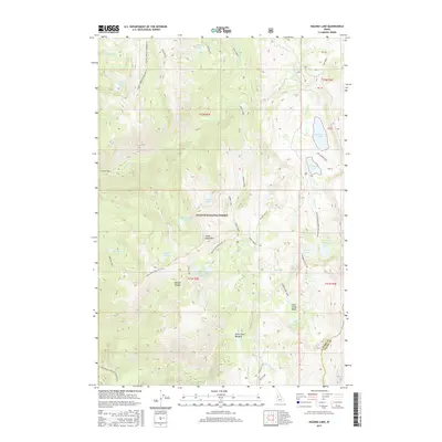
2017 Map of Hazard Lake
USGS Topo · Published 2017About this map
Payette National Forest dominates this high-altitude landscape where the Grass Mountains and Lava Ridge define the watershed. The area is characterized by a dense concentration of alpine waters, including Big Hazard Lake, Morgan Lake, and the uniquely named Coffee Cup Lake. The 2017 data illustrates a network of recreational access points such as the Hidden Lake Loop and the Big Hazard ATV trail, which navigate the complex topography between Bascom Canyon and Hard Creek Basin. Geodetic boundaries for t22n r2e and adjacent townships intersect near Hard Butte, marking the survey divisions of this remote Idaho backcountry. The map also captures the transition between Idaho and Valley Counties, providing a clear record of the drainage patterns from Vance Creek and Hazard Creek as they descend from the high meadows.
Find a feature on this map
49 named features on this map. Tap any name to fly to it.
Don’t see what you’re looking for? This feature index may not catch every label — zoom into the map to look around manually.
Map Details
Editions of this 2017 Hazard Lake Map
This is the sole edition of this map. No revisions or reprints were ever made.
Other maps of this area

1938 · Riggins
USGS Topo · 1:96,000

1945 · Riggins
USGS Topo · 1:125,000

1955 · Grangeville
USGS Topo · 1:250,000

1959 · Grangeville
USGS Topo · 1:250,000

1963 · Bally Mountain
USGS Topo · 1:24,000

1963 · Indian Mountain
USGS Topo · 1:24,000

1963 · Granite Lake
USGS Topo · 1:24,000

1963 · Black Tip
USGS Topo · 1:24,000

1963 · Hershey Point
USGS Topo · 1:24,000
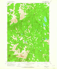
1963 · Hazard Lake
USGS Topo · 1:24,000