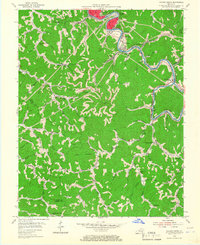
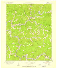
1954 Map of Hazard South
USGS Topo · Published 1967About this map
Hazard and the industrial corridor along the North Fork Kentucky River dominate the northern edge of this mid-century survey. The landscape is defined by the L & N railroad winding through narrow valleys to serve coal-loading points and company settlements like Lothair, Glomawr, and Diablock. The south and west portions of the sheet transition into a dense network of hollows and ridges, where life centered on small rural institutions like the Eversole Sch, Big Creek Ch, and Sulphur Springs Sch.
Find a feature on this map
74 named features on this map. Tap any name to fly to it.
Don’t see what you’re looking for? This feature index may not catch every label — zoom into the map to look around manually.
Map Details
Editions of this 1954 Hazard South Map
2 editions found
Other maps of this area

1891 · Hazard
USGS Topo · 1:125,000

1913 · Buckhorn
USGS Topo · 1:62,500

1914 · Troublesome
USGS Topo · 1:62,500

1916 · Cornettsville
USGS Topo · 1:62,500

1916 · Hyden
USGS Topo · 1:48,000

1919 · Hyden
USGS Topo · 1:62,500

1954 · Krypton
USGS Topo · 1:24,000
1954 · Hyden East
USGS Topo · 1:24,000
1954 · Tilford
USGS Topo · 1:24,000
1954 · Vicco
USGS Topo · 1:24,000