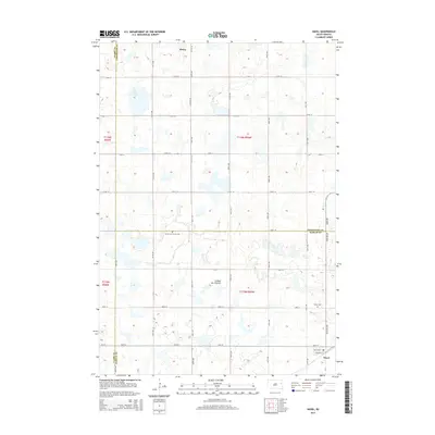
2015 Map of Hazel
USGS Topo · Published 2015About this map
Henry and Hazel anchor this section of the South Dakota prairie, situated within the distinctive glacial landscape of the Coteau des Prairies. The terrain is defined by a dense network of small wetlands and potholes, reflecting the unique topography of this highland plateau. The town of Henry sits near the northern margin of the sheet beside Lake Henry, while the community of Hazel is positioned in the southeast corner.
Find a feature on this map
34 named features on this map. Tap any name to fly to it.
Don’t see what you’re looking for? This feature index may not catch every label — zoom into the map to look around manually.
Map Details
Editions of this 2015 Hazel Map
This is the sole edition of this map. No revisions or reprints were ever made.
Other maps of this area

1953 · Watertown
USGS Topo · 1:250,000

1958 · Watertown
USGS Topo · 1:250,000

1973 · Garden City
USGS Topo · 1:24,000
1973 · Henry
USGS Topo · 1:24,000

1973 · Bryant NE
USGS Topo · 1:24,000

1973 · Vienna West
USGS Topo · 1:24,000
1973 · Kampeska
USGS Topo · 1:24,000

1973 · Naples
USGS Topo · 1:24,000
1973 · Grover
USGS Topo · 1:24,000

1973 · Vienna East
USGS Topo · 1:24,000