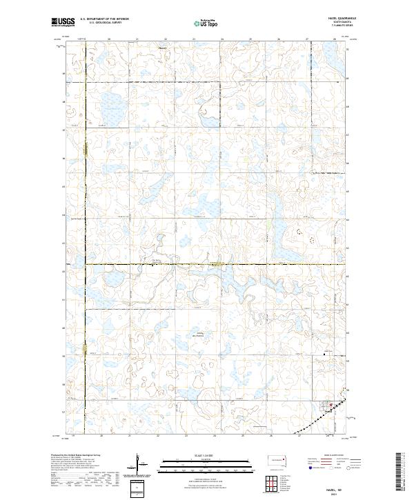
2021 Map of Hazel
USGS Topo · Published 2021About this map
Hazel sits at the intersection of Mustang Ave and 180th St in the southeastern corner of this landscape, serving as a focal point for the surrounding prairie farmsteads. The terrain is part of the Coteau des Prairies, a high plateau characterized by a dense network of small wetlands and glacial potholes that stretch between the settlements. To the north, Henry anchors the map near the shores of Lake Henry, illustrating the persistent relationship between these Eastern South Dakota communities and the local hydrology.
Find a feature on this map
39 named features on this map. Tap any name to fly to it.
Don’t see what you’re looking for? This feature index may not catch every label — zoom into the map to look around manually.
Map Details
Editions of this 2021 Hazel Map
This is the sole edition of this map. No revisions or reprints were ever made.
Other maps of this area

1953 · Watertown
USGS Topo · 1:250,000

1958 · Watertown
USGS Topo · 1:250,000

1973 · Garden City
USGS Topo · 1:24,000
1973 · Henry
USGS Topo · 1:24,000

1973 · Bryant NE
USGS Topo · 1:24,000

1973 · Vienna West
USGS Topo · 1:24,000
1973 · Kampeska
USGS Topo · 1:24,000

1973 · Naples
USGS Topo · 1:24,000
1973 · Grover
USGS Topo · 1:24,000

1973 · Vienna East
USGS Topo · 1:24,000