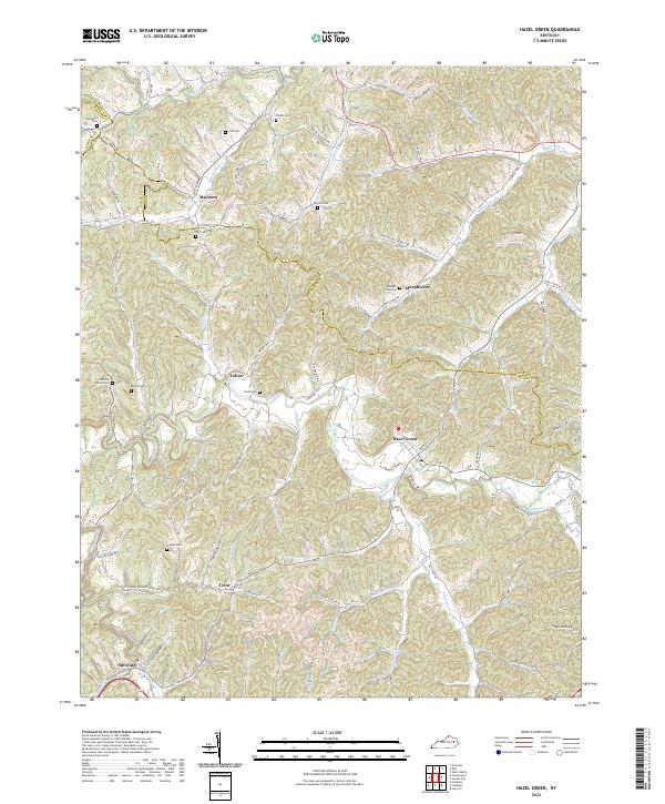
2022 Map of Hazel Green
USGS Topo · Published 2022About this map
The Red River carves a winding path through the borderlands of Wolfe, Morgan, and Menifee counties, anchoring a landscape defined by sharp elevation changes and narrow hollows. In the southern portion of the sheet, the Red Wild And Scenic River designation highlights the corridor's ecological importance. Small communities like Hazel Green and Stillwater are situated along the valley floors, connected by a network of rural roads that follow the contours of the land, such as State Hwy 1010.
Find a feature on this map
85 named features on this map. Tap any name to fly to it.
Don’t see what you’re looking for? This feature index may not catch every label — zoom into the map to look around manually.
Map Details
Editions of this 2022 Hazel Green Map
This is the sole edition of this map. No revisions or reprints were ever made.
Other maps of this area

1889 · Salyersville
USGS Topo · 1:125,000

1891 · Salyersville
USGS Topo · 1:125,000

1892 · Beattyville
USGS Topo · 1:125,000

1899 · Salyersville
USGS Topo · 1:125,000

1951 · Cannel City
USGS Topo · 1:24,000

1951 · Landsaw
USGS Topo · 1:24,000

1951 · Ezel
USGS Topo · 1:24,000

1951 · Hazel Green
USGS Topo · 1:24,000

1951 · Pomeroyton
USGS Topo · 1:24,000
1951 · West Liberty
USGS Topo · 1:24,000