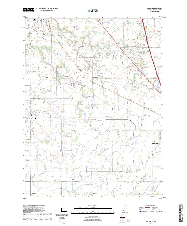
2022 Map of Hazelrigg
USGS Topo · Published 2022About this map
Thorntown and Hazelrigg anchor the northern reaches of this central Indiana landscape, where the agricultural grid is intersected by the long diagonal of the Big Four Trl. This trail follows the historical corridor of the Big Four Railroad, a former transportation artery that once linked these rural communities to larger markets. The terrain is defined by a dense network of watercourses and managed drainage, including Little Sugar Cr, Wolf Cr, and Higgins Ditch, illustrating the extensive water management required for the region's productive farmland.
Find a feature on this map
52 named features on this map. Tap any name to fly to it.
Don’t see what you’re looking for? This feature index may not catch every label — zoom into the map to look around manually.
Map Details
Editions of this 2022 Hazelrigg Map
This is the sole edition of this map. No revisions or reprints were ever made.
Other maps of this area

1953 · Fayette
USGS Topo · 1:24,000

1953 · Lizton
USGS Topo · 1:24,000

1953 · Lebanon
USGS Topo · 1:24,000

1953 · Danville
USGS Topo · 1:250,000

1953 · Indianapolis
USGS Topo · 1:250,000

1955 · Danville
USGS Topo · 1:250,000

1956 · Danville
USGS Topo · 1:250,000

1956 · Indianapolis
USGS Topo · 1:250,000

1957 · Indianapolis
USGS Topo · 1:250,000

1957 · New Ross
USGS Topo · 1:24,000