
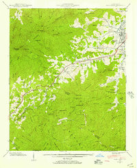
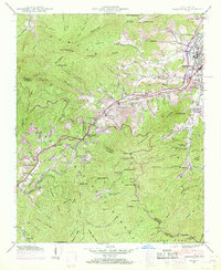
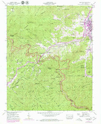
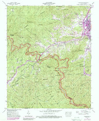
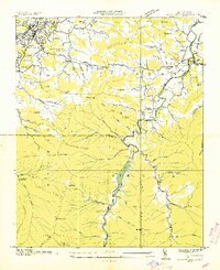
1941 Map of Hazelwood
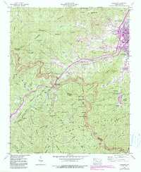
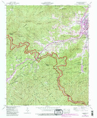
USGS Topo · Published 1957About this map
The high ridges of the Plott Balsams and Pinnacle Ridge dominate this terrain, where the Southern railroad winds through the critical Balsam Gap at the county line between Haywood and Jackson. This crossing was a vital link for the regional timber and transport economy during the early 1940s. Nearby, the presence of the Prison Camp and the Grassy Ridge Mine reflect the era’s intensive land use and industrial activity in the Blue Ridge.
Find a feature on this map
86 named features on this map. Tap any name to fly to it.
Don’t see what you’re looking for? This feature index may not catch every label — zoom into the map to look around manually.
Map Details
Editions of this 1941 Hazelwood Map
7 editions found
Other maps of this area

1891 · Cowee
USGS Topo · 1:125,000

1893 · Mt Guyot
USGS Topo · 1:125,000

1894 · Asheville
USGS Topo · 1:125,000

1897 · Cowee
USGS Topo · 1:125,000

1901 · Asheville
USGS Topo · 1:125,000

1905 · Pisgah
USGS Topo · 1:125,000

1906 · Pisgah
USGS Topo · 1:125,000

1907 · Cowee
USGS Topo · 1:125,000

1912 · Mt Guyot
USGS Topo · 1:125,000
1935 · Waynesville
USGS Topo · 1:24,000