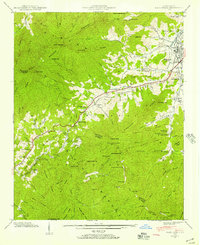
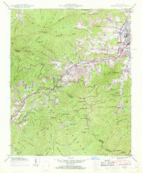
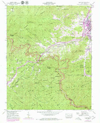
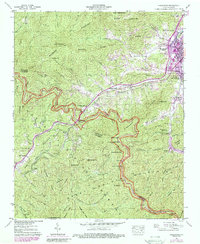
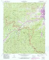
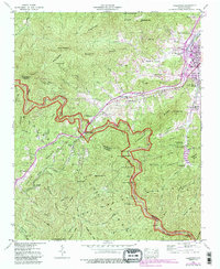
1941 Map of Hazelwood
USGS Topo · Published 1960About this map
Waynesville and Hazelwood anchor the northern reaches of this 1941 survey, where the valley of Richland Creek meets the foothills of the Plott Balsam and Balsam ranges. The Southern railroad line winds through the corridor toward Balsam Gap, serving a landscape defined by mountain agriculture and early conservation efforts like the Morrison Fish Hatchery. High-elevation landmarks such as Pinnacle Knob and Jones Knob tower over a network of remote settlements and mountain schools, including the Allen Creek Sch Ch and Micadale Ch.
Find a feature on this map
108 named features on this map. Tap any name to fly to it.
Don’t see what you’re looking for? This feature index may not catch every label — zoom into the map to look around manually.
Map Details
Editions of this 1941 Hazelwood Map
7 editions found

Other maps of this area

1891 · Cowee
USGS Topo · 1:125,000

1893 · Mt Guyot
USGS Topo · 1:125,000

1894 · Asheville
USGS Topo · 1:125,000

1897 · Cowee
USGS Topo · 1:125,000

1901 · Asheville
USGS Topo · 1:125,000

1905 · Pisgah
USGS Topo · 1:125,000

1906 · Pisgah
USGS Topo · 1:125,000

1907 · Cowee
USGS Topo · 1:125,000

1912 · Mt Guyot
USGS Topo · 1:125,000
1935 · Waynesville
USGS Topo · 1:24,000