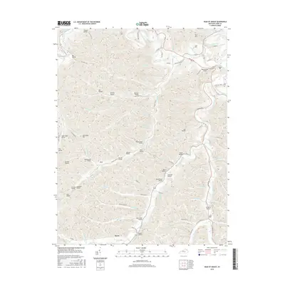
2016 Map of Head of Grassy
USGS Topo · Published 2016About this map
The community of Harris and the Head of Grassy settlement anchor this terrain in Lewis County, Kentucky. This landscape is defined by an intricate network of deep hollows and narrow ridges, drained by Kinniconick Creek and its many tributaries like Cherry Camp Cr and Straight Fork. The names on the land, such as Schoolhouse Hollow and Oil Well Hollow, reflect a history of early rural education and resource extraction. Smaller settlements like Awe appear nestled within the valleys, connected by a winding network of local routes including Horsley Cemetery Rd and Fairlane Dr. High points such as High Rock and Lost Hill overlook a region where family-named landmarks like Psimer Hollow and Blankenship Hollow indicate deep-rooted local heritage and land ownership patterns characteristic of the eastern Kentucky hills.
Find a feature on this map
103 named features on this map. Tap any name to fly to it.
Don’t see what you’re looking for? This feature index may not catch every label — zoom into the map to look around manually.
Map Details
Editions of this 2016 Head of Grassy Map
This is the sole edition of this map. No revisions or reprints were ever made.
Other maps of this area

1915 · Garrison
USGS Topo · 1:62,500

1918 · Garrison
USGS Topo · 1:62,500

1919 · Vanceburg
USGS Topo · 1:62,500

1949 · Vanceburg
USGS Topo · 1:62,500

1949 · Garrison
USGS Topo · 1:24,000

1949 · Vanceburg
USGS Topo · 1:24,000

1949 · Charters
USGS Topo · 1:24,000

1950 · Charters
USGS Topo · 1:24,000

1950 · Head Of Grassy
USGS Topo · 1:24,000

1950 · Wesleyville
USGS Topo · 1:24,000