
1949 Map of Garrison
USGS Topo · Published 1961About this map
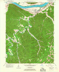
Garrison and Quincy anchor this 1949 survey of the south bank of the Ohio River, where the Chesapeake and Ohio railroad corridor follows the narrow river bottom. The interior of Lewis County is defined by a dense network of hollows and ridges, many bearing the names of early settler families, such as Moore Hollow and Garden Hollow. The landscape is heavily marked by the educational and spiritual centers of these rural communities, including the Spy Run Sch, Red Brush Sch, and Bevins Chapel.
Find a feature on this map
97 named features on this map. Tap any name to fly to it.
Don’t see what you’re looking for? This feature index may not catch every label — zoom into the map to look around manually.
Map Details
Editions of this 1949 Garrison Map
5 editions found
Other maps of this area

1915 · Garrison
USGS Topo · 1:62,500

1918 · Garrison
USGS Topo · 1:62,500

1919 · Vanceburg
USGS Topo · 1:62,500

1949 · Pond Run
USGS Topo · 1:24,000

1949 · Vanceburg
USGS Topo · 1:62,500

1949 · Friendship
USGS Topo · 1:24,000

1949 · Buena Vista
USGS Topo · 1:24,000

1949 · Vanceburg
USGS Topo · 1:24,000

1949 · Brushart
USGS Topo · 1:24,000

1950 · Brushart
USGS Topo · 1:24,000