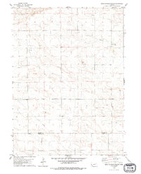
1979 Map of Head Of Rocky Hollow
USGS Topo · Published 1993About this map
Rocky Hollow defines the central terrain of this Western Nebraska landscape, where the high plains of the Panhandle meet the drainage systems of the High Plains. This 1970s survey captures a transition point in rural land use, documenting small outposts like Young and Linn situated amidst a growing infrastructure of energy and industry. The presence of numerous Oil Wells and a major Pipeline cutting across the southwestern quadrant indicates the region's mid-century development as a petroleum-producing area. Straddling the boundary between Banner Co and Kimball Co, the map reveals a sparsely populated but active environment, including a Gravel Pit and scattered wells that support the local ranching and industrial economy during this era of agricultural modernization.
Find a feature on this map
9 named features on this map. Tap any name to fly to it.
Don’t see what you’re looking for? This feature index may not catch every label — zoom into the map to look around manually.
Map Details
Editions of this 1979 Head Of Rocky Hollow Map
2 editions found
Other maps of this area

1898 · Scotts Bluff
USGS Topo · 1:125,000

1899 · Goshen Hole
USGS Topo · 1:125,000

1954 · Scottsbluff
USGS Topo · 1:250,000

1954 · Cheyenne
USGS Topo · 1:250,000

1958 · Cheyenne
USGS Topo · 1:250,000

1958 · Scottsbluff
USGS Topo · 1:250,000

1960 · Tremain
USGS Topo · 1:24,000

1963 · Lindbergh
USGS Topo · 1:24,000

1973 · Kimball 2 NE
USGS Topo · 1:24,000

1973 · Kimball 2 SE
USGS Topo · 1:24,000