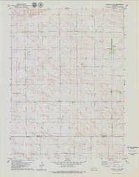
1979 Map of Kimball 2 NW
USGS Topo · Published 1979About this map
Banner and Kimball Counties meet across this high plains landscape, surveyed in the mid-1970s to document the area's rural development and topography. The map illustrates a sparse settlement pattern characteristic of the Nebraska panhandle, featuring the named locations of Linn and Young. This era of mapping highlights the expansion of the energy and resource extraction industries in the region, clearly marked by several Oil Wells and a Gravel Pit scattered across the township lines. The terrain is defined by the natural drainage of Rocky Hollow, while a prominent Pipeline cuts across the southern portion of the sheet, signaling the infrastructure required to transport the area's subterranean wealth. Genealogists and local historians will find value in the specific placement of these rural landmarks and the precise delineations of the Range 57 and 58 West boundary lines.
Find a feature on this map
10 named features on this map. Tap any name to fly to it.
Don’t see what you’re looking for? This feature index may not catch every label — zoom into the map to look around manually.
Map Details
Editions of this 1979 Kimball 2 NW Map
2 editions found
Other maps of this area

1898 · Scotts Bluff
USGS Topo · 1:125,000

1899 · Goshen Hole
USGS Topo · 1:125,000

1954 · Scottsbluff
USGS Topo · 1:250,000

1954 · Cheyenne
USGS Topo · 1:250,000

1958 · Cheyenne
USGS Topo · 1:250,000

1958 · Scottsbluff
USGS Topo · 1:250,000

1960 · Tremain
USGS Topo · 1:24,000

1963 · Lindbergh
USGS Topo · 1:24,000

1973 · Kimball 2 NE
USGS Topo · 1:24,000

1973 · Kimball 2 SE
USGS Topo · 1:24,000