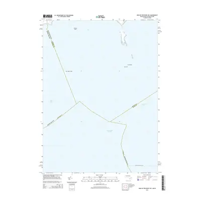
2015 Map of Head of Westport OE S
USGS Topo · Published 2015About this map
The Atlantic Ocean and Rhode Island Sound dominate this maritime survey, which documents the complex boundary intersections between Massachusetts and Rhode Island. Navigational hazards such as Old Cock, The Wildcat, and Twomile Ledge punctuate the waters south of Westport, providing critical landmarks for coastal mariners and maritime historians. The map traces the path of the Intracoastal Waterway as it moves through these open waters, alongside the designated route for the Martha's Vineyard Fast Fry. This sheet is particularly notable for its detailed depiction of county and state boundaries, showing where Bristol, Newport, and Dukes counties meet in the offshore waters of the Atlantic.
Find a feature on this map
13 named features on this map. Tap any name to fly to it.
Don’t see what you’re looking for? This feature index may not catch every label — zoom into the map to look around manually.
Map Details
Editions of this 2015 Head of Westport OE S Map
This is the sole edition of this map. No revisions or reprints were ever made.
Other maps of this area

1885 · New Bedford
USGS Topo · 1:62,500

1885 · Sakonnet
USGS Topo · 1:62,500

1888 · New Bedford
USGS Topo · 1:62,500

1888 · Fall River
USGS Topo · 1:62,500

1888 · Sakonnet
USGS Topo · 1:62,500

1893 · Sakonnet
USGS Topo · 1:62,500

1893 · Fall River
USGS Topo · 1:62,500

1893 · New Bedford
USGS Topo · 1:62,500

1918 · New Bedford
USGS Topo · 1:62,500

1919 · Fall River
USGS Topo · 1:62,500