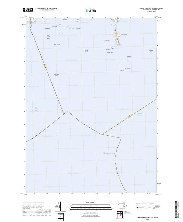
2024 Map of Head of Westport OE S
USGS Topo · Published 2024About this map
Gooseberry Neck and the surrounding waters of Rhode Island Sound define this coastal survey at the borders of Massachusetts and Rhode Island. The map focuses heavily on the navigational hazards and undersea features of the Atlantic Ocean shelf, documenting a dense cluster of ledges, rocks, and grounds. Shoreline access is concentrated at the northern edge where W Beach Rd and E Beach Rd meet near Bar Rock.
Find a feature on this map
36 named features on this map. Tap any name to fly to it.
Don’t see what you’re looking for? This feature index may not catch every label — zoom into the map to look around manually.
Map Details
Editions of this 2024 Head of Westport OE S Map
This is the sole edition of this map. No revisions or reprints were ever made.
Other maps of this area

1885 · New Bedford
USGS Topo · 1:62,500

1885 · Sakonnet
USGS Topo · 1:62,500

1888 · New Bedford
USGS Topo · 1:62,500

1888 · Fall River
USGS Topo · 1:62,500

1888 · Sakonnet
USGS Topo · 1:62,500

1893 · Sakonnet
USGS Topo · 1:62,500

1893 · Fall River
USGS Topo · 1:62,500

1893 · New Bedford
USGS Topo · 1:62,500

1918 · New Bedford
USGS Topo · 1:62,500

1919 · Fall River
USGS Topo · 1:62,500