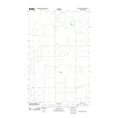
2011 Map of Headlight Butte
USGS Topo · Published 2011About this map
Headlight Butte rises as the central landmark of this Glacier County landscape, which is defined by a rigorous grid of section lines and gravel roads. The terrain is sparsely settled, punctuated by specialized outposts such as Whetstone Camp and infrastructure like the Montana Power Camp Rd. Water management is essential in this high plains environment, as evidenced by the Omicron Dam situated in the northeast.
Find a feature on this map
13 named features on this map. Tap any name to fly to it.
Don’t see what you’re looking for? This feature index may not catch every label — zoom into the map to look around manually.
Map Details
Editions of this 2011 Headlight Butte Map
This is the sole edition of this map. No revisions or reprints were ever made.
Other maps of this area

1907 · Blackfoot Res.
USGS Topo · 1:48,000

1909 · Cut Bank
USGS Topo · 1:125,000

1912 · Cut Bank
USGS Topo · 1:125,000

1960 · Cut Bank
USGS Topo · 1:250,000

1963 · Cut Bank
USGS Topo · 1:250,000

1964 · Cut Bank
USGS Topo · 1:250,000

1966 · Ethridge NW
USGS Topo · 1:24,000
1966 · Cut Bank
USGS Topo · 1:24,000
1966 · Gunsight
USGS Topo · 1:24,000

1968 · Headlight Butte NE
USGS Topo · 1:24,000