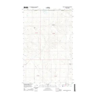
2014 Map of Headlight Butte NW
USGS Topo · Published 2014About this map
Boundary Lake defines the northern edge of this high plains landscape, sitting directly against the international border between the United States of America and Canada. This 2014 survey reveals a terrain shaped by deep drainage features, most notably the winding path of Big Rock Coulee and its associated East Fork Big Rock Coulee, which carve through the land in Glacier County. The map provides a clear look at the rural transportation network in this remote portion of northern Montana, tracing local thoroughfares such as Reagan Rd and Glendale Cutacross Rd. Researchers will find a strictly delineated landscape of township and range lines, where long county roads like Moberly Rd and Korner Rd serve as the primary markers of human presence in a territory dominated by open topography.
Find a feature on this map
14 named features on this map. Tap any name to fly to it.
Don’t see what you’re looking for? This feature index may not catch every label — zoom into the map to look around manually.
Map Details
Editions of this 2014 Headlight Butte NW Map
This is the sole edition of this map. No revisions or reprints were ever made.
Other maps of this area

1909 · Cut Bank
USGS Topo · 1:125,000

1911 · Blackfoot
USGS Topo · 1:125,000

1912 · Cut Bank
USGS Topo · 1:125,000

1960 · Cut Bank
USGS Topo · 1:250,000

1963 · Cut Bank
USGS Topo · 1:250,000

1964 · Cut Bank
USGS Topo · 1:250,000

1968 · Headlight Butte NE
USGS Topo · 1:24,000
1968 · Dead Indian Spring
USGS Topo · 1:24,000
1968 · Love Rock
USGS Topo · 1:24,000

1968 · Rocky Buttes
USGS Topo · 1:24,000