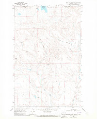
1968 Map of Headlight Butte NW
USGS Topo · Published 1972About this map
The Blackfeet Indian Reservation occupies the eastern portion of this landscape, where the high plains meet the international border between Alberta and Montana. The terrain is defined by the deep incisions of Big Rock Coulee and its tributary, East Fork Big Rock Coulee, which snake through the northern reaches of Glacier County.
Find a feature on this map
11 named features on this map. Tap any name to fly to it.
Don’t see what you’re looking for? This feature index may not catch every label — zoom into the map to look around manually.
Map Details
Editions of this 1968 Headlight Butte NW Map
This is the sole edition of this map. No revisions or reprints were ever made.
Other maps of this area

1909 · Cut Bank
USGS Topo · 1:125,000

1911 · Blackfoot
USGS Topo · 1:125,000

1912 · Cut Bank
USGS Topo · 1:125,000

1960 · Cut Bank
USGS Topo · 1:250,000

1963 · Cut Bank
USGS Topo · 1:250,000

1964 · Cut Bank
USGS Topo · 1:250,000

1968 · Headlight Butte NE
USGS Topo · 1:24,000
1968 · Dead Indian Spring
USGS Topo · 1:24,000
1968 · Love Rock
USGS Topo · 1:24,000

1968 · Rocky Buttes
USGS Topo · 1:24,000