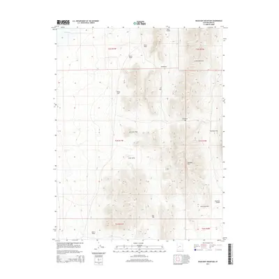
2014 Map of Headlight Mountain
USGS Topo · Published 2014About this map
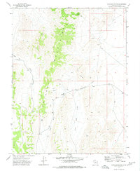
Headlight Mtn and the eastern ridges of the Cricket Mountains dominate this high-desert landscape in central Utah. The map reveals a complex system of drainage and relief, where named features like Dorthy Draw and Red Valley carve through the limestone and dolomite formations. To the northwest, the edge of Sevier Lake provides a sharp contrast to the surrounding arid terrain. This 2014 survey documents the physical geography of a largely uninhabited portion of Millard County, characterized by remote passes and distinct summits. Strategic landmarks such as Monument Point and Petes Knoll rise above the alluvial fans of Cedar Valley and Shorts Valley, while natural corridors like Cys Pass and Headlight Pass offer the only logical routes through the steep vertical breaks of the range.
Find a feature on this map
23 named features on this map. Tap any name to fly to it.
Don’t see what you’re looking for? This feature index may not catch every label — zoom into the map to look around manually.
Map Details
Editions of this 2014 Headlight Mountain Map
This is the sole edition of this map. No revisions or reprints were ever made.
Other maps of this area

1885 · Beaver
USGS Topo · 1:250,000

1953 · Richfield
USGS Topo · 1:250,000

1958 · Richfield
USGS Topo · 1:250,000

1960 · Beaver Lake Mts.
USGS Topo · 1:62,500

1972 · Headlight Mtn
USGS Topo · 1:24,000
1972 · Needle Point
USGS Topo · 1:24,000
1972 · Sevier Lake NE
USGS Topo · 1:24,000
1972 · Sevier Lake SW
USGS Topo · 1:24,000

1973 · Black Rock
USGS Topo · 1:24,000
1973 · Candland Spring
USGS Topo · 1:24,000