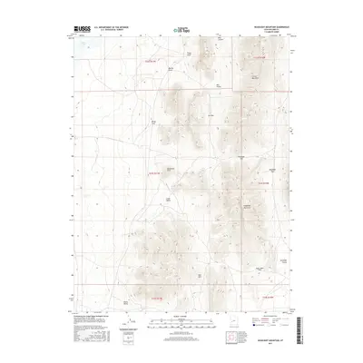
2017 Map of Headlight Mountain
USGS Topo · Published 2017About this map
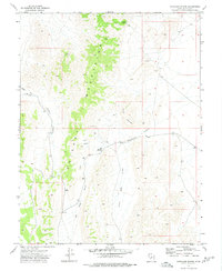
Headlight Mountain dominates this portion of the Cricket Mountains in Millard County, representing a landscape defined by Great Basin topography and intermittent drainage systems. In the northern reaches of this 2017 survey, the shoreline of Sevier Lake borders the high desert terrain. The area is characterized by a series of north-south trending valleys and passes, including Cedar Valley, Shorts Valley, and Red Valley, which provide natural corridors through the peaks. This survey preserves local naming conventions for various geographical features, such as Dorthy Draw, Wingy Cove, and Cys Pass, as well as identifying topographic landmarks like Monument Point and the Red Hills. The presence of Mine Canyon suggests a history of resource exploration in these highlands, while established routes like Headlight Pass and Lone Cedar Pass indicate the historical importance of mountain transit in this arid region.
Find a feature on this map
23 named features on this map. Tap any name to fly to it.
Don’t see what you’re looking for? This feature index may not catch every label — zoom into the map to look around manually.
Map Details
Editions of this 2017 Headlight Mountain Map
This is the sole edition of this map. No revisions or reprints were ever made.
Other maps of this area

1885 · Beaver
USGS Topo · 1:250,000

1953 · Richfield
USGS Topo · 1:250,000

1958 · Richfield
USGS Topo · 1:250,000

1960 · Beaver Lake Mts.
USGS Topo · 1:62,500

1972 · Headlight Mtn
USGS Topo · 1:24,000
1972 · Needle Point
USGS Topo · 1:24,000
1972 · Sevier Lake NE
USGS Topo · 1:24,000
1972 · Sevier Lake SW
USGS Topo · 1:24,000

1973 · Black Rock
USGS Topo · 1:24,000
1973 · Candland Spring
USGS Topo · 1:24,000