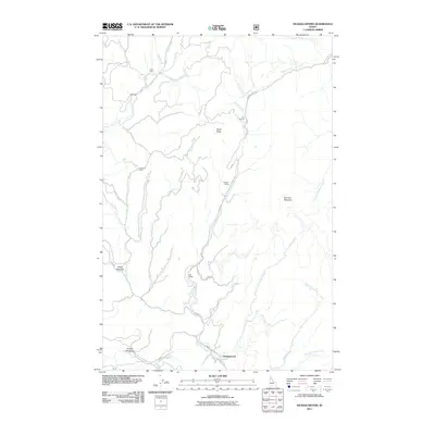
2011 Map of Headquarters
USGS Topo · Published 2011About this map
Headquarters stands as the primary hub in this pocket of the Idaho backcountry, situated at the confluence of several vital transit routes like Grangemont Rd and NFD RD 247. The landscape is defined by the legacy of mountain operations, evidenced by the numerous specialized locations such as Murphy Siding, Alan Siding, and the multiple sites designated as Old Camp and Old Camp 6. These markers, along with Casey Cabin and Neisham Cabin, suggest a history of seasonal or industrial habitation tied to the surrounding timber and terrain.
Find a feature on this map
28 named features on this map. Tap any name to fly to it.
Don’t see what you’re looking for? This feature index may not catch every label — zoom into the map to look around manually.
Map Details
Editions of this 2011 Headquarters Map
This is the sole edition of this map. No revisions or reprints were ever made.
Other maps of this area

1923 · Washington Creek
USGS Topo · 1:125,000

1936 · Boehls Butte
USGS Topo · 1:48,000

1938 · Headquarters
USGS Topo · 1:48,000

1943 · Boehls Butte
USGS Topo · 1:62,500

1944 · Headquarters
USGS Topo · 1:62,500

1956 · Hamilton
USGS Topo · 1:250,000

1959 · Hamilton
USGS Topo · 1:250,000

1960 · Hamilton
USGS Topo · 1:250,000

1964 · Hamilton
USGS Topo · 1:250,000

1965 · French Mountain
USGS Topo · 1:24,000