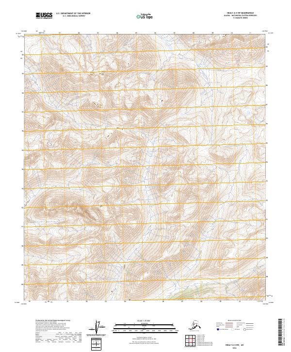
2024 Map of Healy A-4 SW
USGS Topo · Published 2024About this map
The East Fork Chulitna River flows through the northern reaches of this interior Alaskan landscape, which is defined by significant elevation changes and glacial drainage patterns. Located in the Matanuska-Susitna Borough, the terrain is marked by the steep descent of Portage Creek in the south, illustrating the drainage system that characterizes this portion of the Healy quadrangle. The lack of named roads or established settlements emphasizes the primitive state of the land, which is organized by the Public Land Survey System grids including t21s r7w and t22s r7w. The dense contour lines reveal high alpine ridges and valleys that remain largely untouched by permanent development, providing a clear view of the natural watercourses before they join larger regional river systems.
Find a feature on this map
8 named features on this map. Tap any name to fly to it.
Don’t see what you’re looking for? This feature index may not catch every label — zoom into the map to look around manually.
Map Details
Editions of this 2024 Healy A-4 SW Map
This is the sole edition of this map. No revisions or reprints were ever made.
Other maps of this area

1950 · Talkeetna Mountains
USGS Topo · 1:250,000

1950 · Talkeetna Mountains D-5
USGS Topo · 1:63,360

1950 · Healy A-4
USGS Topo · 1:63,360

1950 · Healy A-5
USGS Topo · 1:63,360

1951 · Healy
USGS Topo · 1:250,000

1951 · Talkeetna Mountains D-5
USGS Topo · 1:63,360

1951 · Talkeetna Mountains D-4
USGS Topo · 1:63,360

1952 · Healy A-4
USGS Topo · 1:63,360

1952 · Healy A-5
USGS Topo · 1:63,360
1952 · Talkeetna Mountains D-4
USGS Topo · 1:63,360