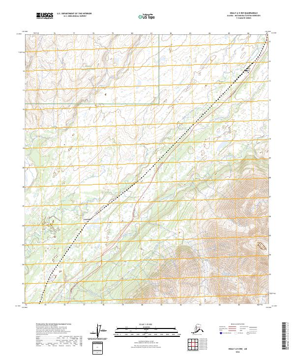
2024 Map of Healy A-5 NW
USGS Topo · Published 2024About this map
Denali National Park encompasses the northwestern portion of this Alaskan landscape, where the Bull River flows through high mountain terrain. The map centers on the critical transportation corridor following the Middle Fork Chulitna River, a valley defined by the Parks Highway. This route connects the small settlements of Colorado and Broad Pass, marking a transit point between the river drainage and the rising slopes of the surrounding peaks. The convergence of the East Fork Chulitna River and smaller tributaries like Fourth of July Creek and Tsusena Creek illustrates the complex hydrology of the Matanuska-Susitna Borough. Short local access routes, such as Colorado Station Road, provide a glimpse into the limited but vital infrastructure supporting these remote stations along the river valley floor.
Find a feature on this map
17 named features on this map. Tap any name to fly to it.
Don’t see what you’re looking for? This feature index may not catch every label — zoom into the map to look around manually.
Map Details
Editions of this 2024 Healy A-5 NW Map
This is the sole edition of this map. No revisions or reprints were ever made.
Other maps of this area

1949 · Healy A-6
USGS Topo · 1:63,360

1950 · Healy A-5
USGS Topo · 1:63,360

1950 · Healy B-5
USGS Topo · 1:63,360

1951 · Healy
USGS Topo · 1:250,000

1951 · Healy B-5
USGS Topo · 1:63,360

1952 · Healy A-5
USGS Topo · 1:63,360

1953 · Healy A-6
USGS Topo · 1:63,360

1953 · Healy B-5
USGS Topo · 1:63,360

1954 · Healy B-6
USGS Topo · 1:63,360
1956 · Healy B-5
USGS Topo · 1:63,360