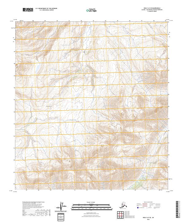
2024 Map of Healy A-5 SE
USGS Topo · Published 2024About this map
Honolulu Pass serves as a critical geographic notch in the high terrain of the Matanuska-Susitna Borough, defining the natural corridor through this interior Alaskan landscape. This modern topographic study reveals a wilderness largely defined by its drainage patterns, notably the headwaters of Honolulu Creek and Crooked Creek. The map is structured by the Public Land Survey System, with the intersection of t21s r9w, t21s r8w, t22s r9w, and t22s r8w providing the legal framework for this expansive territory. The concentration of wetlands and intricate contour lines around the pass indicates the complex hydrology of the high-elevation divide, offering a precise look at the landforms as they exist in the early twenty-first century.
Find a feature on this map
7 named features on this map. Tap any name to fly to it.
Don’t see what you’re looking for? This feature index may not catch every label — zoom into the map to look around manually.
Map Details
Editions of this 2024 Healy A-5 SE Map
This is the sole edition of this map. No revisions or reprints were ever made.
Other maps of this area

1950 · Talkeetna Mountains
USGS Topo · 1:250,000

1950 · Talkeetna Mountains D-5
USGS Topo · 1:63,360

1950 · Healy A-4
USGS Topo · 1:63,360

1950 · Healy A-5
USGS Topo · 1:63,360

1951 · Healy
USGS Topo · 1:250,000

1951 · Talkeetna Mountains D-5
USGS Topo · 1:63,360

1951 · Talkeetna Mountains D-4
USGS Topo · 1:63,360

1952 · Healy A-4
USGS Topo · 1:63,360

1952 · Healy A-5
USGS Topo · 1:63,360
1952 · Talkeetna Mountains D-4
USGS Topo · 1:63,360