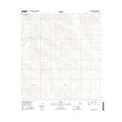
2016 Map of Healy A-6 SW
USGS Topo · Published 2016About this map
Denali National Park encompasses the northwestern portion of this Alaskan wilderness, where high-altitude drainages feed into the broader valley systems of the Matanuska-Susitna Borough. The landscape is defined by its glacial activity and complex network of watercourses, most notably the Eldridge Glacier which dominates the southwestern corner. From these icy origins, numerous creeks carve through the terrain, including McCallie Cr and the branching systems of Shotgun Cr and Little Shotgun Cr. The map reveals a wild, roadless expanse where the hydrological patterns suggest a highly dynamic environment. The convergence of Ohio Cr, Christy Cr, and Coal Cr highlights a watershed that remains largely untouched by permanent settlement, offering a clear view of the natural topography as it existed in the early twenty-first century.
Find a feature on this map
13 named features on this map. Tap any name to fly to it.
Don’t see what you’re looking for? This feature index may not catch every label — zoom into the map to look around manually.
Map Details
Editions of this 2016 Healy A-6 SW Map
This is the sole edition of this map. No revisions or reprints were ever made.
Other maps of this area

1949 · Talkeetna Mountains D-6
USGS Topo · 1:63,360

1949 · Healy A-6
USGS Topo · 1:63,360

1950 · Talkeetna Mountains
USGS Topo · 1:250,000

1950 · Talkeetna
USGS Topo · 1:250,000

1951 · Talkeetna
USGS Topo · 1:250,000

1951 · Healy
USGS Topo · 1:250,000

1951 · Talkeetna Mountains D-6
USGS Topo · 1:63,360

1952 · Mount McKinley
USGS Topo · 1:250,000

1952 · Talkeetna Mountains D-6
USGS Topo · 1:63,360

1953 · Healy A-6
USGS Topo · 1:63,360