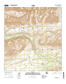
2016 Map of Healy B-4 NE
USGS Topo · Published 2016About this map
The Alaska Range provides the high-elevation backdrop for this interior Alaskan landscape, dominated by the winding course of the Nenana River. Flowing northward through a terrain defined by dramatic topographic relief, the river serves as the primary drainage for several glacial-fed tributaries including Schist Cr, Slime Cr, and Bruskasna Cr. A portion of McKinley Park is visible in the northern section, representing a time of shifting administrative boundaries in this wilderness region.
Find a feature on this map
14 named features on this map. Tap any name to fly to it.
Don’t see what you’re looking for? This feature index may not catch every label — zoom into the map to look around manually.
Map Details
Editions of this 2016 Healy B-4 NE Map
This is the sole edition of this map. No revisions or reprints were ever made.
Other maps of this area

1949 · Healy B-4
USGS Topo · 1:63,360

1949 · Healy C-3
USGS Topo · 1:63,360

1950 · Healy C-4
USGS Topo · 1:63,360

1950 · Healy B-3
USGS Topo · 1:63,360

1951 · Healy
USGS Topo · 1:250,000

1951 · Healy B-4
USGS Topo · 1:63,360
1952 · Healy C-4
USGS Topo · 1:63,360
1952 · Healy B-3
USGS Topo · 1:63,360
1952 · Healy C-3
USGS Topo · 1:63,360

1956 · Healy
USGS Topo · 1:250,000