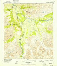
1952 Map of Healy C-4
USGS Topo · Published 1952About this map
The Alaska Railroad carves a critical path through this 1952 landscape, following the course of the Nenana River and marking the eastern edge of Mt McKinley National Park. The survey illustrates the intersection of industrial transport and conservation, showing the National Park Boundary weaving through a corridor defined by the rail line and the river. Near the northern edge, the Mt McKinley National Park Headquarters and an Airstrip serve as early focal points for park access near McKinley Park.
Find a feature on this map
36 named features on this map. Tap any name to fly to it.
Don’t see what you’re looking for? This feature index may not catch every label — zoom into the map to look around manually.
Map Details
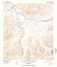
Editions of this 1952 Healy C-4 Map
2 editions found
Other maps of this area

1949 · Healy B-4
USGS Topo · 1:63,360

1949 · Healy C-3
USGS Topo · 1:63,360

1950 · Healy D-4
USGS Topo · 1:63,360

1950 · Healy C-4
USGS Topo · 1:63,360

1950 · Healy B-3
USGS Topo · 1:63,360

1950 · Healy D-3
USGS Topo · 1:63,360

1950 · Healy B-5
USGS Topo · 1:63,360

1951 · Healy
USGS Topo · 1:250,000

1951 · Healy B-5
USGS Topo · 1:63,360

1951 · Healy B-4
USGS Topo · 1:63,360