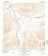
1952 Map of Healy C-4
USGS Topo · Published 1952About this map
Mt McKinley National Park Headquarters serves as the focal point for this wilderness survey, situated where the Alaska Railroad and the Nenana River converge. The mapping reveals a remote transport and industrial corridor defined by the rail line, which connects isolated stations and settlements like McKinley Park, Lagoon, Yanert, and Carlo. A notable industrial artifact is the Coal Mine (Aband) located south of Yanert, indicating early 20th-century resource extraction efforts within this high-latitude environment.
Find a feature on this map
29 named features on this map. Tap any name to fly to it.
Don’t see what you’re looking for? This feature index may not catch every label — zoom into the map to look around manually.
Map Details
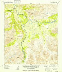
Editions of this 1952 Healy C-4 Map
2 editions found
Other maps of this area

1949 · Healy B-4
USGS Topo · 1:63,360

1949 · Healy C-3
USGS Topo · 1:63,360

1950 · Healy D-4
USGS Topo · 1:63,360

1950 · Healy C-4
USGS Topo · 1:63,360

1950 · Healy B-3
USGS Topo · 1:63,360

1950 · Healy D-3
USGS Topo · 1:63,360

1950 · Healy B-5
USGS Topo · 1:63,360

1951 · Healy
USGS Topo · 1:250,000

1951 · Healy B-5
USGS Topo · 1:63,360

1951 · Healy B-4
USGS Topo · 1:63,360