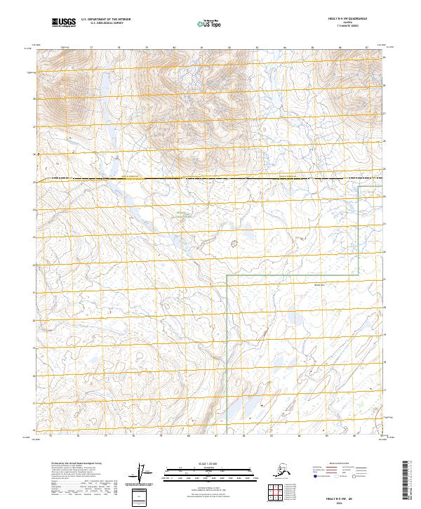
2024 Map of Healy B-5 SW
USGS Topo · Published 2024About this map
Denali National Park and the Denali Wilderness meet at the boundary of the Denali Borough and Matanuska-Susitna Borough in this high-altitude wilderness survey. The landscape is defined by the broad corridors of glacier-fed drainages, most notably the Bull River and Cantwell Creek, which carve through the terrain south of the Alaska Range. The presence of Broad Pass indicates a critical low-elevation gap through the mountains, historically used for travel and transportation across the interior divide.
Find a feature on this map
12 named features on this map. Tap any name to fly to it.
Don’t see what you’re looking for? This feature index may not catch every label — zoom into the map to look around manually.
Map Details
Editions of this 2024 Healy B-5 SW Map
This is the sole edition of this map. No revisions or reprints were ever made.
Other maps of this area

1949 · Healy A-6
USGS Topo · 1:63,360

1950 · Healy A-5
USGS Topo · 1:63,360

1950 · Healy B-5
USGS Topo · 1:63,360

1951 · Healy
USGS Topo · 1:250,000

1951 · Healy B-5
USGS Topo · 1:63,360

1952 · Healy A-5
USGS Topo · 1:63,360

1953 · Healy A-6
USGS Topo · 1:63,360

1953 · Healy B-5
USGS Topo · 1:63,360

1954 · Healy B-6
USGS Topo · 1:63,360
1956 · Healy B-5
USGS Topo · 1:63,360