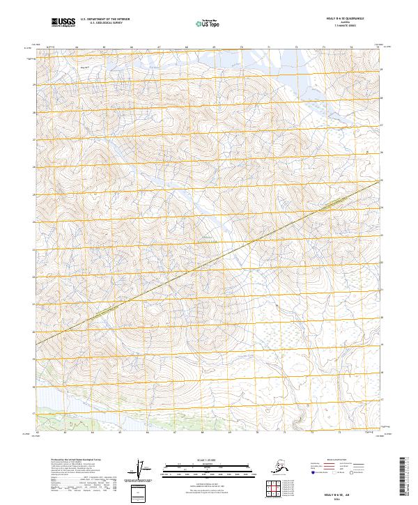
2024 Map of Healy B-6 SE
USGS Topo · Published 2024About this map
Denali National Park and the adjacent Denali Wilderness define the interior of this high-latitude landscape, where the boundary between the Denali Borough and Matanuska-Susitna Borough cuts diagonally across the terrain. The hydrological network is the primary structure of the area, characterized by the south-flowing Costello Creek and the West Fork Chulitna River at the southern edge. The presence of Easy Pass in the northwest suggests a natural corridor through the higher elevations, while watercourses like Bull River and Colorado Creek drain the surrounding slopes. This 2024 survey captures a section of the Alaska Range where protected federal lands meet borough lines, reflecting a modern landscape still dominated by natural drainage patterns rather than infrastructure.
Find a feature on this map
13 named features on this map. Tap any name to fly to it.
Don’t see what you’re looking for? This feature index may not catch every label — zoom into the map to look around manually.
Map Details
Editions of this 2024 Healy B-6 SE Map
This is the sole edition of this map. No revisions or reprints were ever made.
Other maps of this area

1949 · Healy A-6
USGS Topo · 1:63,360

1950 · Healy A-5
USGS Topo · 1:63,360

1950 · Healy B-5
USGS Topo · 1:63,360

1951 · Healy
USGS Topo · 1:250,000

1951 · Healy B-5
USGS Topo · 1:63,360

1952 · Healy A-5
USGS Topo · 1:63,360

1953 · Healy A-6
USGS Topo · 1:63,360

1953 · Healy B-5
USGS Topo · 1:63,360

1954 · Healy B-6
USGS Topo · 1:63,360
1956 · Healy B-5
USGS Topo · 1:63,360