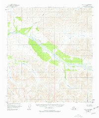
1949 Map of Healy C-3
USGS Topo · Published 1977About this map
Yanert Fork dominates the drainage of this interior Alaskan wilderness as it appeared during the late 1940s. The landscape is defined by its deep valley systems and high ridgelines, where glacial fed waters like Grizzly Creek and Moose Creek carve through the terrain. This topographic study reflects the state of the territory just after the war, showing a region where natural landforms remained the primary features before significant modern development. Tributaries such as Dick Creek, Dean Creek, and Louis Creek are meticulously charted along their winding paths, providing a foundational view of the hydrology south of the McKinley area. To the southeast, Edgar Cr and Revine Creek further illustrate the complex network of mountain streams that characterize this subarctic environment.
Find a feature on this map
11 named features on this map. Tap any name to fly to it.
Don’t see what you’re looking for? This feature index may not catch every label — zoom into the map to look around manually.
Map Details
Editions of this 1949 Healy C-3 Map
2 editions found
Other maps of this area

1949 · Healy B-4
USGS Topo · 1:63,360

1949 · Healy C-3
USGS Topo · 1:63,360

1949 · Healy B-2
USGS Topo · 1:63,360

1950 · Healy D-4
USGS Topo · 1:63,360

1950 · Healy C-4
USGS Topo · 1:63,360

1950 · Healy B-3
USGS Topo · 1:63,360

1950 · Healy D-3
USGS Topo · 1:63,360

1951 · Healy
USGS Topo · 1:250,000

1951 · Healy B-4
USGS Topo · 1:63,360

1951 · Healy C-2
USGS Topo · 1:63,360