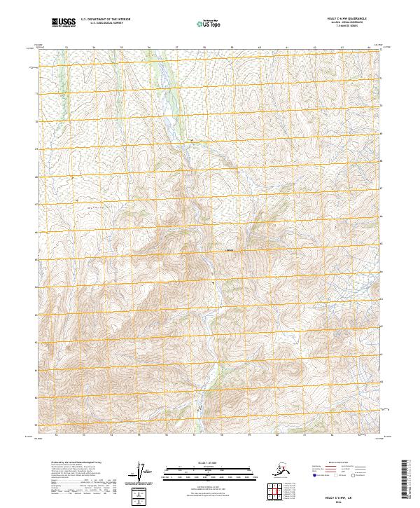
2024 Map of Healy C-6 NW
USGS Topo · Published 2024About this map
Denali Wilderness lands define this interior Alaskan landscape, dominated by a network of glacial river systems and high-altitude terrain. The East Fork Toklat River bisects the region, carving a wide braided path through the center of the survey. To the west, the Wyoming Hills provide a significant topographic barrier, while the eastern edge is marked by the winding course of the Sushana River. Small alpine features like the Lagoon and headwaters of Wigand Creek highlight the drainage patterns typical of this subarctic environment. This 2024 survey by the U.S. Geological Survey utilizes data from the National Hydrography Dataset and National Elevation Dataset to provide a precise view of the modern wilderness boundaries and natural watercourses as they exist today.
Find a feature on this map
6 named features on this map. Tap any name to fly to it.
Don’t see what you’re looking for? This feature index may not catch every label — zoom into the map to look around manually.
Map Details
Editions of this 2024 Healy C-6 NW Map
This is the sole edition of this map. No revisions or reprints were ever made.
Other maps of this area

1951 · Healy
USGS Topo · 1:250,000

1951 · Mount McKinley D-1
USGS Topo · 1:63,360

1951 · Healy D-6
USGS Topo · 1:63,360

1952 · Mount McKinley
USGS Topo · 1:250,000

1952 · Mount McKinley C-1
USGS Topo · 1:63,360

1954 · Healy C-6
USGS Topo · 1:63,360

1954 · Mount McKinley D-1
USGS Topo · 1:63,360

1954 · Mount McKinley C-1
USGS Topo · 1:63,360
1954 · Healy D-6
USGS Topo · 1:63,360

1956 · Healy
USGS Topo · 1:250,000