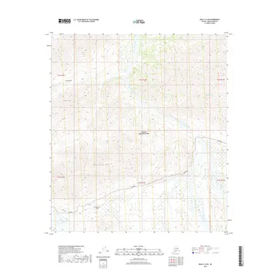
2019 Map of Healy C-6 SW
USGS Topo · Published 2019About this map
Denali National Park and its interior road corridor are the primary subjects of this 2019 survey, illustrating the high-altitude topography of the Alaska Range. The Park Road winds through the southern half of the map, providing the only vehicle access into this protected landscape. It traverses the landmark Polychrome Pass south of Polychrome Mt, a region defined by its complex drainage systems. The East Fork Toklat River and the main branch of the Toklat River dominate the central and eastern valleys, while the northwestern corner is marked by Cabin Peak and the nearby Cabin Divide. The mapping of small drainages like Tributary Cr and Cabin Cr clarifies the watershed patterns that shaped the park's early exploration routes and current infrastructure.
Find a feature on this map
16 named features on this map. Tap any name to fly to it.
Don’t see what you’re looking for? This feature index may not catch every label — zoom into the map to look around manually.
Map Details
Editions of this 2019 Healy C-6 SW Map
This is the sole edition of this map. No revisions or reprints were ever made.
Other maps of this area

1951 · Healy
USGS Topo · 1:250,000

1952 · Mount McKinley
USGS Topo · 1:250,000

1952 · Mount McKinley B-1
USGS Topo · 1:63,360

1952 · Mount McKinley C-1
USGS Topo · 1:63,360

1954 · Healy C-6
USGS Topo · 1:63,360

1954 · Healy B-6
USGS Topo · 1:63,360

1954 · Mount McKinley C-1
USGS Topo · 1:63,360

1954 · Mount McKinley B-1
USGS Topo · 1:63,360

1956 · Healy
USGS Topo · 1:250,000

1958 · Mount McKinley
USGS Topo · 1:250,000