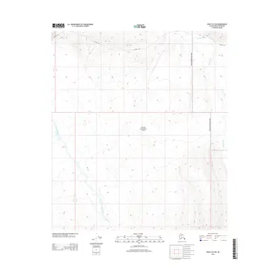
2014 Map of Healy D-6 SW
USGS Topo · Published 2014About this map
Denali National Park encompasses the majority of this landscape, where the high-altitude terrain is defined by dramatic elevation changes and a network of glacial river systems. The northern portion of the map is traversed by the Stampede Trail, a route originally established to provide access to mining claims in the early twentieth century. This historic path cuts across the drainage of the Sushana River, which flows northward through the rugged eastern section of the quadrangle. To the west, the E Fork Toklat River carves through the mountains, illustrating the complex hydrology of the Alaska Range. The survey clearly delineates the boundary between the national park and adjacent lands, providing a precise record of the corridor between Townships 12 and 13 South.
Find a feature on this map
7 named features on this map. Tap any name to fly to it.
Don’t see what you’re looking for? This feature index may not catch every label — zoom into the map to look around manually.
Map Details
Editions of this 2014 Healy D-6 SW Map
This is the sole edition of this map. No revisions or reprints were ever made.
Other maps of this area

1951 · Healy
USGS Topo · 1:250,000

1951 · Mount McKinley D-1
USGS Topo · 1:63,360

1951 · Healy D-6
USGS Topo · 1:63,360

1952 · Mount McKinley
USGS Topo · 1:250,000

1952 · Mount McKinley C-1
USGS Topo · 1:63,360

1954 · Healy C-6
USGS Topo · 1:63,360

1954 · Mount McKinley D-1
USGS Topo · 1:63,360

1954 · Mount McKinley C-1
USGS Topo · 1:63,360
1954 · Healy D-6
USGS Topo · 1:63,360

1956 · Healy
USGS Topo · 1:250,000