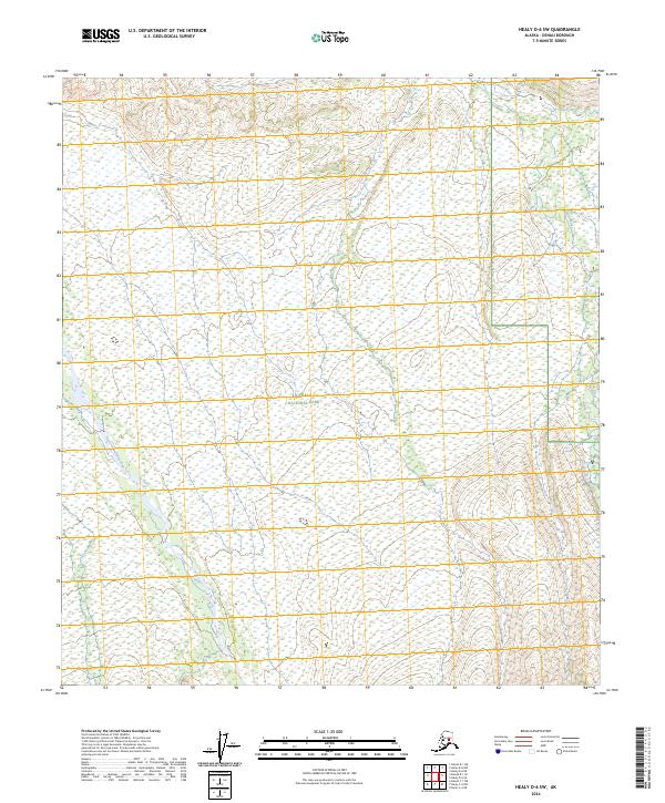
2024 Map of Healy D-6 SW
USGS Topo · Published 2024About this map
Denali National Park and the protected Denali Wilderness comprise the vast majority of this interior Alaskan landscape. This 2024 survey details a transition from high-altitude ridge lines in the southeast to expansive, water-saturated wetlands across the northern sections. The Sushana River and the East Fork Toklat River carve through the terrain, defining the local hydrology and serving as primary landmarks for any traverse through this wilderness. Grounded in data from the U.S. Geological Survey and the National Hydrography Dataset, the map illustrates the complex braiding of glacial rivers as they emerge from the mountains. This specific quadrangle serves as a precise record of contemporary conservation boundaries and the natural drainage patterns that have shaped the Denali region into the 21st century.
Find a feature on this map
9 named features on this map. Tap any name to fly to it.
Don’t see what you’re looking for? This feature index may not catch every label — zoom into the map to look around manually.
Map Details
Editions of this 2024 Healy D-6 SW Map
This is the sole edition of this map. No revisions or reprints were ever made.
Other maps of this area

1951 · Healy
USGS Topo · 1:250,000

1951 · Mount McKinley D-1
USGS Topo · 1:63,360

1951 · Healy D-6
USGS Topo · 1:63,360

1952 · Mount McKinley
USGS Topo · 1:250,000

1952 · Mount McKinley C-1
USGS Topo · 1:63,360

1954 · Healy C-6
USGS Topo · 1:63,360

1954 · Mount McKinley D-1
USGS Topo · 1:63,360

1954 · Mount McKinley C-1
USGS Topo · 1:63,360
1954 · Healy D-6
USGS Topo · 1:63,360

1956 · Healy
USGS Topo · 1:250,000