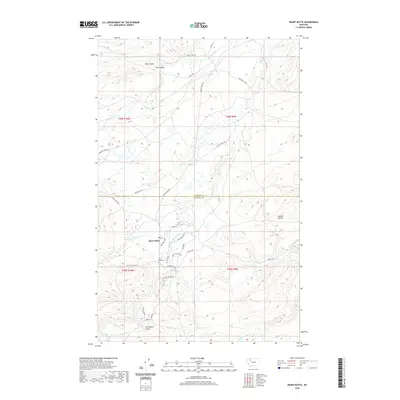
2020 Map of Heart Butte
USGS Topo · Published 2020About this map
Heart Butte serves as the focal point for this landscape on the Blackfeet Indian Reservation, where the terrain transitions through a series of significant drainages and coulees. The settlement pattern is defined by a network of rural roads and trails, many bearing descriptive or family names like Skunk Village Rd, New Dayrider Rd, and Spotted Wolf Trl. Local community life is anchored by Saint Anne Cem and infrastructure like School House Rd, positioned near the confluence of N Fork Whitetail Cr and the main branch of Whitetail Cr. The geography is heavily marked by the drainage systems of Badger Creek and various coulees, including Bite Coulee and Tail Feather Coulee, reflecting a landscape tied to traditional movement and natural landmarks along the county line between Glacier and Pondera.
Find a feature on this map
39 named features on this map. Tap any name to fly to it.
Don’t see what you’re looking for? This feature index may not catch every label — zoom into the map to look around manually.
Map Details
Editions of this 2020 Heart Butte Map
This is the sole edition of this map. No revisions or reprints were ever made.
Other maps of this area

1914 · Heart Butte
USGS Topo · 1:125,000

1918 · Heart Butte
USGS Topo · 1:125,000

1960 · Cut Bank
USGS Topo · 1:250,000

1963 · Cut Bank
USGS Topo · 1:250,000

1964 · Cut Bank
USGS Topo · 1:250,000

1968 · Swift Reservoir
USGS Topo · 1:24,000
1968 · Piegan
USGS Topo · 1:24,000

1968 · Fish Lake
USGS Topo · 1:24,000

1968 · White Man Coulee
USGS Topo · 1:24,000
1968 · Magee Ranch
USGS Topo · 1:24,000